About Me
I am a PhD candidate in the Department of Geography at the University of Florida, Climate Sciences concentration. My research focuses on understanding, detecting, and predicting heat waves and extreme weather events through the integration of numerical climate models with advanced machine learning techniques.
Research Focus
My work addresses critical challenges in climate science by developing data-driven approaches that enhance our capacity to forecast extreme weather events and support climate adaptation strategies. I am particularly interested in:
- Heat wave dynamics and thermodynamic drivers
- Extreme weather event mechanisms and predictability
- Climate variability and change across temporal scales
- Earth system feedbacks and teleconnections
- Integration of earth system models with machine learning methods
Selected Ongoing Research
A graph neural network stacked on a physical ensemble produces calibrated week 3-4 heat forecasts of opportunity over the United States
Heat is the deadliest weather hazard in the United States, and the decisions that blunt its impact are taken two to four weeks ahead, at a lead time where forecast skill is famously scarce. This work asks whether a machine-learned weather model can add decision-relevant value at this range when it is used not as a stand-alone predictor, but as one input to a calibrated probabilistic system.
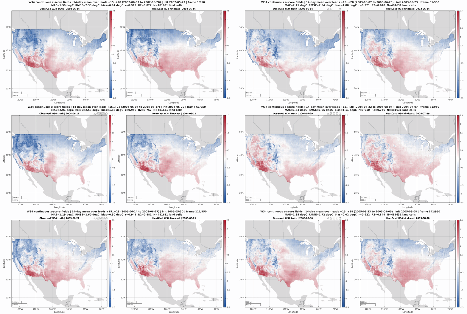
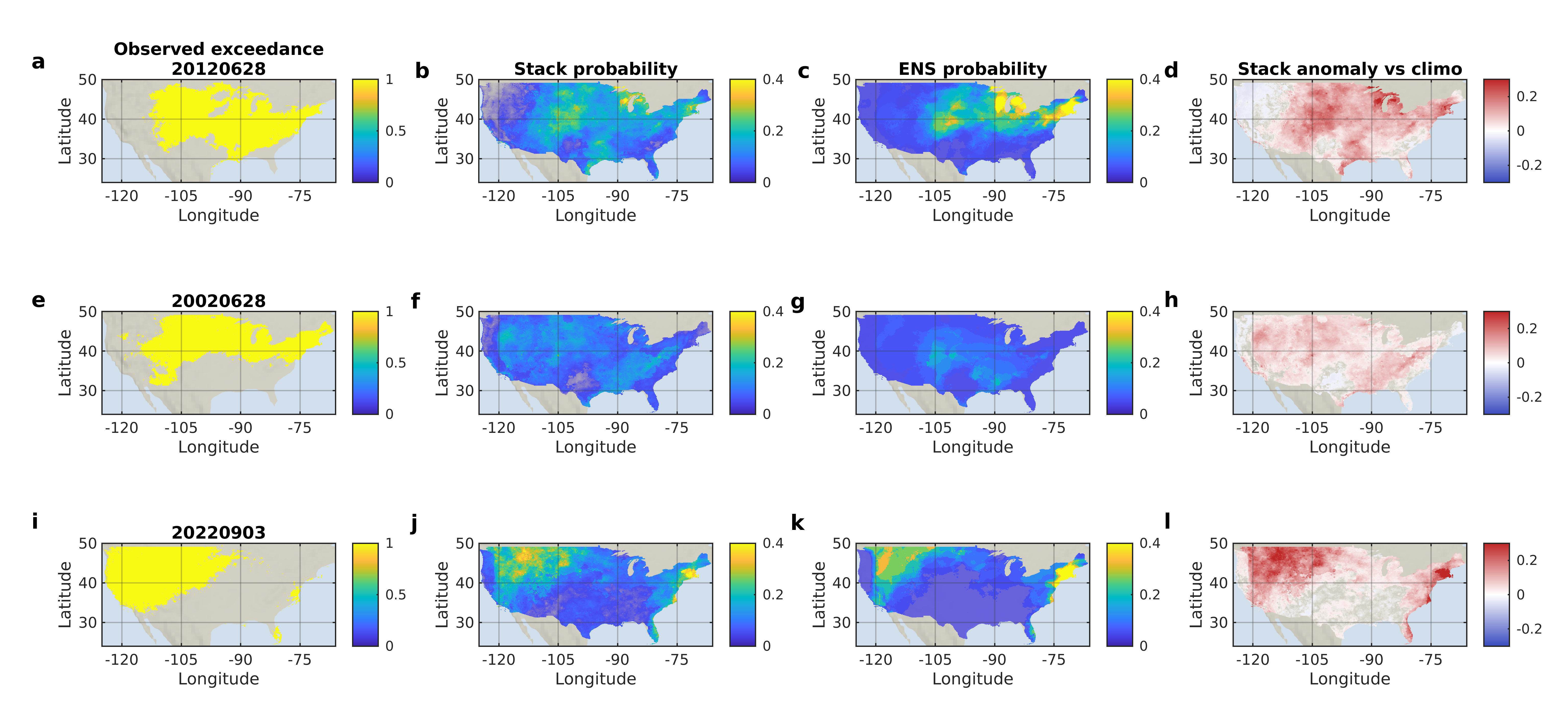
We build HeatCast, a GraphCast-style mesh graph neural network that issues week 3-4 (W34) distributional forecasts of daily maximum temperature over the contiguous United States. HeatCast probabilities, forecast margins, and predicted spread are combined with a calibrated physical ensemble through a transparent cross-fit logistic stacker.
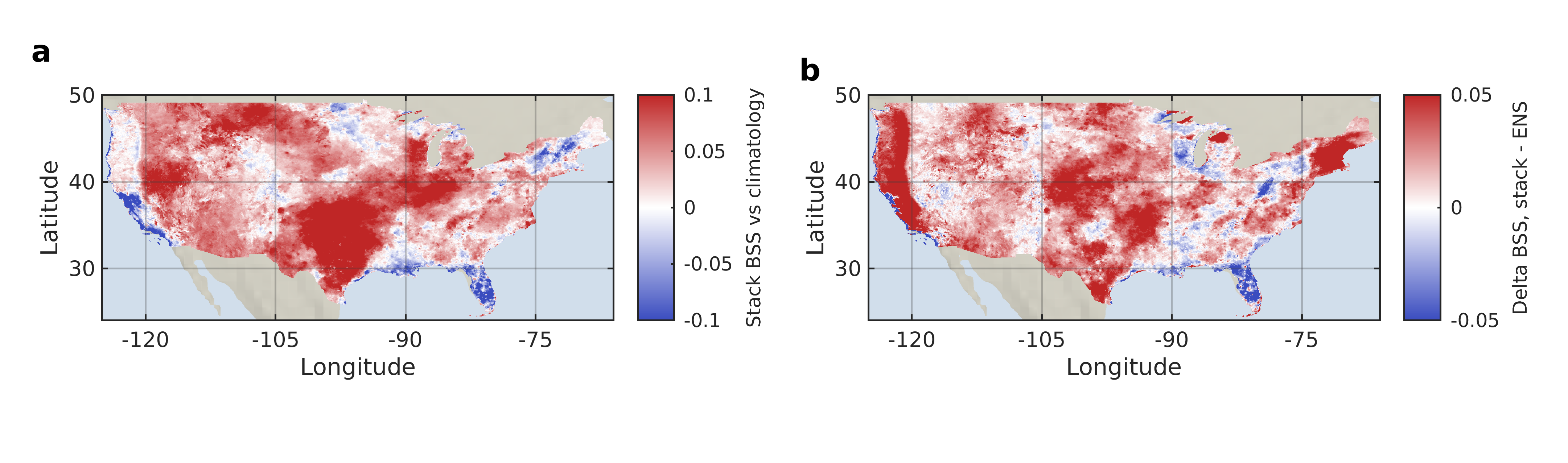
Verified on 22 years of held-out hindcasts (2002-2023, 950 paired initializations, and 4.6 x 10^8 grid-cell samples), the stacked forecast raises the Brier skill score for W34 heat exceedance by 0.021 above the calibrated ensemble and the area under the ROC curve by 0.041, while remaining sharply calibrated. The improvement is state dependent and concentrates in physically expected windows of opportunity, including La Nina conditions, active MJO phases, anomalously dry soils, and the model's own high-confidence, low-spread forecasts.
Spatial Clustering of Heatwave Regimes Through ConvAE Latent Space Analysis and Teleconnection Linkages
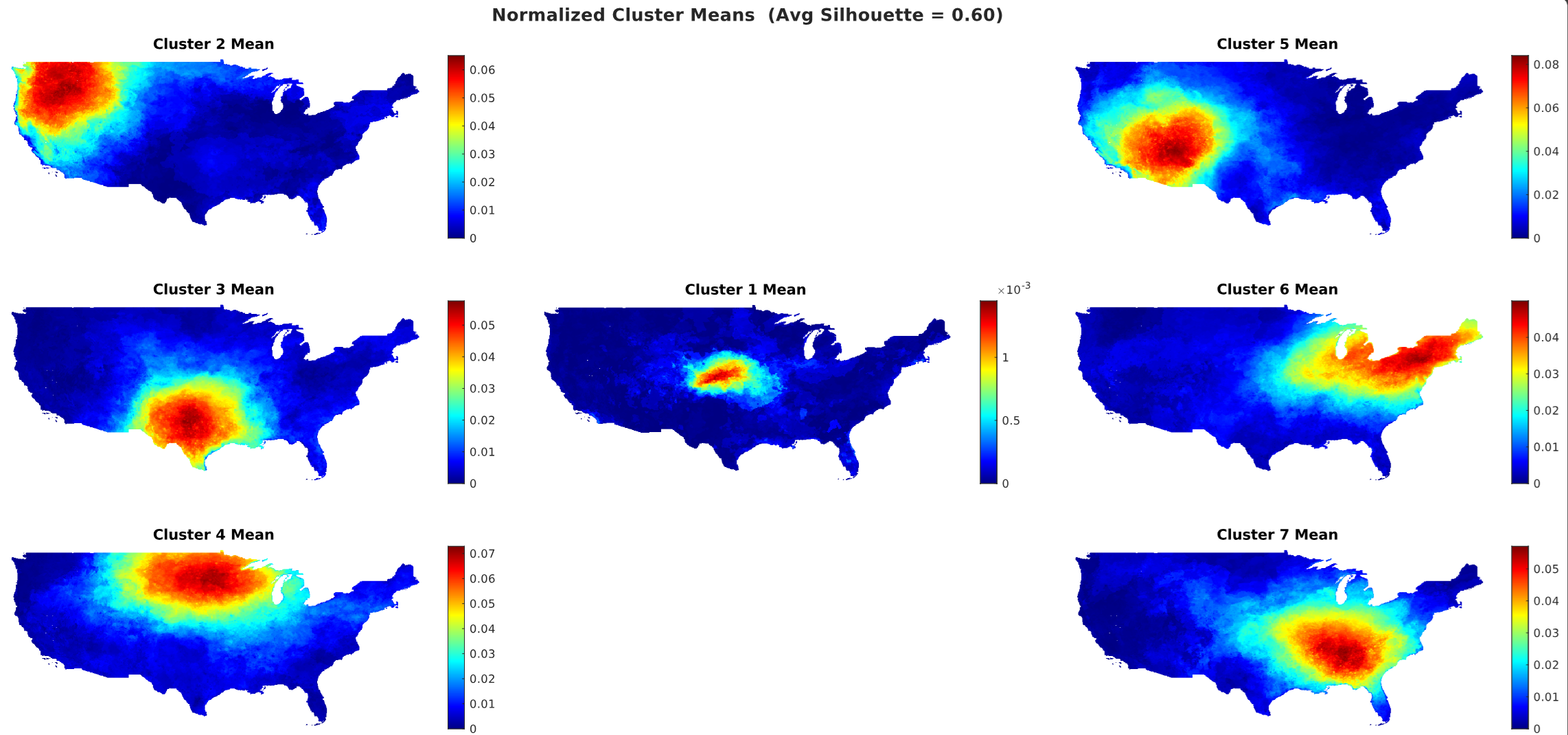
This manuscript develops an unsupervised deep-learning framework for identifying spatially coherent heatwave regimes across the contiguous United States. Daily maximum-temperature fields from PRISM are transformed into Heat Severity and Coverage Index (HSCI) fields for May through September heatwave days, and a convolutional autoencoder (ConvAE) learns compact latent representations of the spatial heatwave structure.
The ConvAE latent space is projected and clustered to recover data-driven heatwave regimes without imposing fixed administrative or climatological boundaries. The resulting maps show coherent western, central, southern, northern, and eastern heatwave footprints, including transitional regions that are not well represented by fixed regional divisions.
The manuscript also connects the spatial regimes to large-scale teleconnection variability. The strongest regime separation is associated with mid-latitude and high-latitude circulation patterns such as PNA, NAO, PDO, and AO, while summer ENSO provides weaker discrimination across the CONUS heatwave regimes.